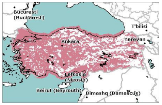
7. Vintage Style - Old Web Map
A map from the olden-days of web mapping when I worked for a telecoms consultancy.
This is one of our late-vintage maps, from the early 2000s, but we built them in the same way from the late 90s:
We took radio planning data from mobile network operators from Planet, Asterix and other radio planning tools and converted them into GeoTIFFs (with some custom extensions).
Our home-grown rendering engine (C++/MFC) combined worldwide vector data with the coverage data
An in-office render farm, controlled by a MS Access-based queue, produced the map tiles
Front-end interactivity was built using Perl and Flash - to search for places and to provide rudimentary scrolling and panning
By today’s standards, the map is pretty basic, but a large number of network operators across the world embedded these maps in their websites and in-store kiosks.

Credits
Image: I think Collins Bartholomew might have provided the map data (I certainly remember visiting them up in Scotland around that time) and the coverage data is from some Turkish mobile network (which may or may not still exist).